Marine and Coastal Hub project leader Dr Eric Lawrey, who is AIMS e-Atlas project manager. Photo: Luke Lythgoe/AIMS.
Scientists have been using satellite technology and unique identification methods to uncover and map new coral reefs in the nation’s north, stretching from waters off western Cape York to Western Australia.
The reefs typically hidden in sediment-rich, murky waters have been mostly invisible and overlooked in conservation and development planning until now, according to the Australian Institute of Marine Science (AIMS).
AIMS has also been scouring the Great Barrier Reef to see whether new reefs can be found as part of The Marine and Coastal Hub project, which has been undertaken in partnership with the University of Queensland (UQ).
Project leader Dr Eric Lawrey, AIMS e-Atlas project manager, said the team’s work revealed more than 1000 new reefs and that northern Australia had a similar number as the Great Barrier Reef, though many were much smaller.
“It’s a vast set of reefs that’s been largely unknown about,” he said.
“Well, I say unknown, maybe I should say unmapped, because I’m sure people that are there, or locals, know about all these places.”
It all started about 12 years ago, when the use of Google Earth and similar satellite imagery became widespread.
Dr Lawrey spent time peering at the northern coastline on screen, noticed possible reefs and wondered why they were not mapped.
“If you look at any one satellite image, the water just looks like turquoise paint and you can’t really see reefs,” he said.
“But if we overlay 200 images of the area taken at different times to create a composite image, all the swirly patterns of the moving water move around and average out while the reefs are constant.

How AIMS is mapping new reefs in the nation’s north. Image: Eric Lawrey.
“Their signal gets reinforced and they become much clearer. It allows us to peek deeper into the water column than we could in one image.
“And that’s pretty much the process we used. Once we could see the reefs, we could map them.”
The process sounds deceptively simple, however, it took the team about 700 hours just to digitise reefs and assign classifications.
Work had to be carried out manually due to false positives using automation techniques and Dr Lawrey said each area of interest “needed a different strategy to map the reefs”.
“And for a lot of them we had to learn about the geology of the place before we could map them,” he said.
Most of the northern Australian coastline was not surveyed before the mapping, according to Dr Lawrey.

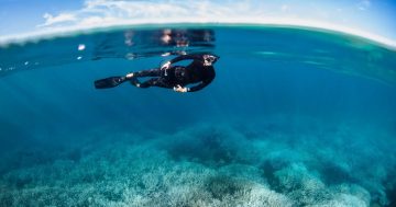
The unique mapping techniques are also being used to get a better overview of the Great Barrier Reef. Photo: James Cook University.
Marine chart mapping did not distinguish between coral and rocky reefs as they were simply designed as a warning to boat operators.
“The number of reefs we found inshore was a surprise. It became a bit of a problem for our project because we had to map so many of them,” Dr Lawrey said.
AIMS hopes the mapping leads to stronger protection for marine ecosystems which went unnoticed.
The project was undertaken while UQ was remapping the outer reefs of the Great Barrier Reef in a separate but similar endeavour.
“They adopted our new imagery technique to identify hundreds of additional reefs and to remove false reefs,” Dr Lawrey said.
The Great Barrier Reef Marine Park Authority is now reviewing the new mapping information.
Funding for the project was provided by the Federal Government.