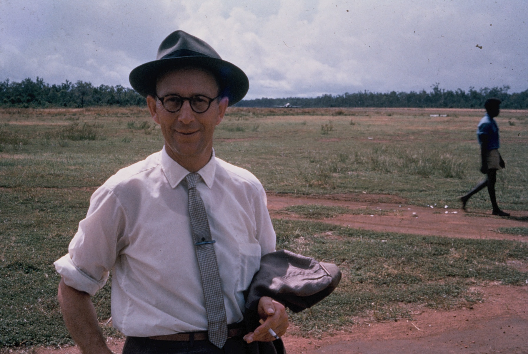
Geologist Harry Evans at the Weipa mission airstrip in 1966. Photo: Forster/Portch slide collection, Cape York Collection, Hibberd Library.
Editor’s note: this article references Aboriginal persons who have passed away.
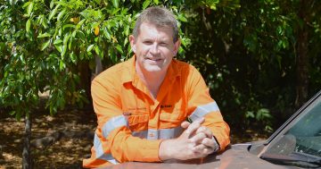
by GEOFF WHARTON
Introduction
The discovery of economic bauxite on the western Cape York Peninsula region 70 years ago led to the development of one of Australia’s major companies: Comalco (now Rio Tinto Aluminium) and the Australian aluminium industry. Although geologist Henry James “Harry” Evans (1912-1990) is credited with making the discovery, he was not the first to recognise the potential of the area’s geological formations. This article examines some of the early European references to bauxite in the region, as well as the later expeditions by Evans in 1955 and the effects of the discovery on the Aboriginal people of the western Cape.
During the period 1891 to 1904, three Presbyterian mission stations were established on Queensland government reserves at Mapoon, Weipa and Aurukun. It was the residents of these missions who later bore the brunt of the mining industry, following the development of commercial bauxite deposits in the 1960s.
Matthew Flinders, 1802
On 3 November 1802, His Majesty’s Ship Investigator, under the command of Commander Matthew Flinders (1774-1814), sailed southwards into the eastern Gulf of Carpentaria. A few kilometres west from the Batavia River (re-named the Wenlock River in 1939), naturalist Robert Brown recorded that while taking soundings with the deep sea lead, “pisiform iron ore” was brought to the surface.
Although Flinders did not mention the finding in his published account, he recorded in the ship’s journal on 6 November that “small round particles of iron ore, shaped like pearls” had been seen during soundings. A specimen was not kept, but it appears likely that this was the first sample of bauxite pisolites or perhaps ironstone (ferricrete, which underlies the Western Cape bauxite deposits) recorded in Australia by Europeans.
While sailing southwards past the coastal feature which Flinders called Pera Head “to preserve the name of the second vessel which, in 1623, sailed along this coast”, he recorded the area was “remarkable for having some reddish cliffs in it, and deep water near the shore”.
It was to be another 153 years before the economic significance of these red cliffs was recognised.
C F V Jackson, 1902
Assistant Queensland Government geologist Clements Frederick Vivian Jackson (1873-1955) made the first modern geological observation of the western Cape York Peninsula region in May 1902, when he visited Mapoon and Weipa Presbyterian missions.
Travelling up the Embley River to the old Weipa Mission station (now known as Twenty Mile, which lies about 30 kilometres east of today’s Napranum community), Jackson described his impressions of the surrounding lands:
In the vicinity of Weipa, the country has a generally level surface, and a series of flats and swamps extend as far as the low sandstone range about 8 miles to the east: rather ferruginous sandstone is to be seen here and there and among the intricacies of the swamps between the Embley and Mission Rivers outcrops of brown pisolitic ironstone …
With considerable foresight, Jackson predicted that it was “probable that if these deposits were systematically examined and sampled, they would be found to include masses of higher-grade ores; and … might ultimately prove of some value, especially on account of their ready accessibility from the sea”. Although Jackson’s comments were published as a Geological Survey of Queensland (GSQ) report, neither the government nor mining companies of the early twentieth century showed any interest in his findings.
Early development of the aluminium industry
Aluminium metal, which is now used in a wide variety of domestic and industrial applications, was first produced commercially in 1854 by French metallurgist H Saint-Claire Deville. Bauxite had been discovered by P Bertier at Les Baux, in the Provence region of southern France in 1821, and was “composed primarily of one or more aluminium hydroxide minerals and impurities of silica, iron oxide and titanium”. Deville’s chemical reduction process was costly and the new metal did not achieve worldwide acceptance until the development of the electrolytic smelting process by Charles Hall in Ohio, United States of America, and Paul Heroult of Normandy, France, in 1886.
Worldwide consumption of aluminium steadily increased during the First World War, then dramatically during the Second World War, when aircraft construction and other metal products stimulated demand for aluminium. An example of this was the Australian-made Beaufort bomber, flown by the Royal Australian Air Force (RAAF), which used Alclad, an aluminium alloy cladding, for the fuselage. By coincidence, an RAAF 7 Squadron Beaufort force-landed near Mapoon in 1943, just 100 kilometres north of the area where bauxite was discovered 12 years later.
Recognition of the strategic importance of aluminium led to the establishment of the Australian Aluminium Production Commission (AAPC) by the Commonwealth Government to assist its defence efforts.
In 1949, the AAPC chose a site at Bell Bay in Tasmania to construct an alumina refinery and aluminium smelter. Once the refinery was completed, bauxite was imported from Malaya to produce the first alumina in Australia in February 1955 and the first aluminium ingot was poured on 23 September that year.
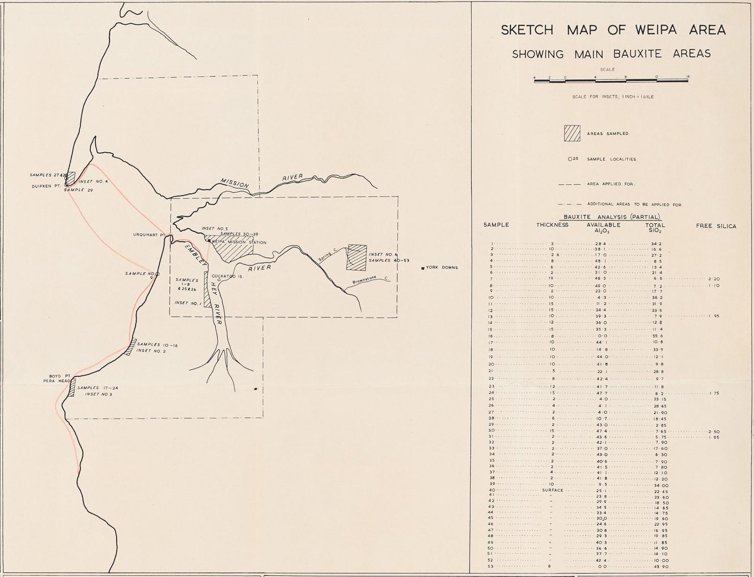
An extract from a map created by Harry Evans following his October 1955 expedition, showing the route (in red) taken in the dinghy. Photo: Digital copy held in the Harry Evans Heritage Collection, Cape York Collection, Hibberd Library.
Harry Evans, Old Matthew, George Wilson and Lea Wassell, 1955
Also in 1955, a party of four geologists employed by Frome-Broken Hill Co Pty Ltd – a company associated with Consolidated Zinc Proprietary Limited (CZP) – conducted an overland reconnaissance of Cape York Peninsula to locate possible oil-bearing structures. The party’s leader, Harry Evans, had been asked by CZP’s exploration director Maurie Mawby, to keep an eye open for other minerals. Evans reported that his group travelled by “jeep and jeep utility, from Normanton north to the Dulhunty River”. Evans called into York Downs station and drove westwards to “see what the country looked like”.
He later recorded the historic events of 16 July 1955 and the days following:
… [O]n the edge of a high tableland [known locally as the Jump Up] overlooking the head waters of the Embley River, I found an outcrop of pisolitic bauxite. The bauxite outcropped as boulders and blocks up to three feet thick. There appeared to be about half a square mile of it. I collected three samples and returned to York Downs station. That night the possibility of continuing west to the Weipa Mission was discussed with the owner of the York Downs station, who stated that a track was known to exist between his station and the Mission. Next day I set off with a native guide. [This probably was George Wilson (Piiramu) of the Kaanju people, then working as a stockman on York Downs.] We reached the Weipa Mission Station that night … En route, we passed over at least six miles [9.6km] of pisolitic material which I sampled at approximately one mile [1.6km] intervals. By this time I was beginning to realise just how extensive the bauxite deposit was and its possible economic significance.
The Weipa mission visitors’ book shows the signatures of geologists Harry Evans, John S Bain and Louis “Lou” H Dixon on 17 July 1955. Evans returned to Weipa in October 1955 to conduct a more comprehensive survey. This time, he had hired a Land Rover and dinghy from Lea Wassell at Silver Plains station.
Accompanied by local Aboriginal elder Old Matthew (Wakmatha – meaning Stormbird – of the Linngithigh people), George Wilson and Lea Wassell, Evans initially inspected the area between Moingum (Hey Point) and Mbang (Urquhart Point) then onwards to Duyfken Point and southwards to Pera Head.
The coastal voyage was not without perils and the dinghy was swamped several times during landing on the beaches. As Evans later wrote, during this journey he “examined 52 miles [83km] of coastline and travelled 180 miles [289km] in a nine feet [2.7-metre] dinghy”. Evans estimated the bauxite reserves at 250 million tonnes.
Establishment of Top Camp by Enterprise Exploration
The announcement in the Cairns Post on 20 August 1956 by Lyell Bryant “Bill” Robinson – chairman of Consolidated Zinc – that his company had discovered “hundreds of millions of tons of bauxite” on Cape York Peninsula heralded the dispossession of the lands of the Mapoon and Weipa Traditional Owners by governments eager to encourage development of Queensland’s north. These lands were classed by the Queensland Government as crown land reserved for Aboriginal people controlled by the Director of Native Affairs as trustee. Under the state laws of that time, neither the Aboriginal people nor the administrators of the Presbyterian Church missions had any form of legal title to the land. It took another 45 years before that dispossession was formally recognised by Comalco during the signing of the Western Cape Communities Co-existence Agreement in 2001.
CZP appointed one of its subsidiary companies, Enterprise Exploration Pty Ltd, to manage the exploration programme and a camp – known as Top Camp – was established at Munding on the Embley River, about a kilometre east of Weipa mission in August 1956. This camp was situated adjacent to the mission airstrip and remained in operation until the new township of Weipa North was built in the mid-1960s.
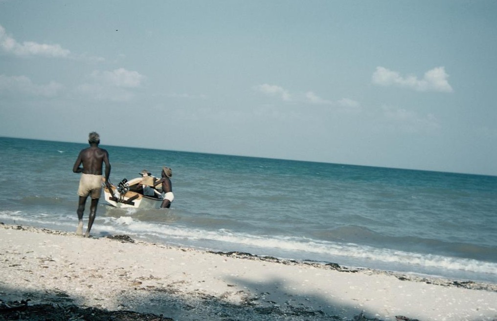
A colour slide photographed by Harry Evans in October 1955, showing the small dinghy in which he and his crew travelled across Albatross Bay. Old Matthew (back to camera) approaches the dinghy at Duyfken Point; Lea Wassell (in hat) is obscured by the bow and George Wilson is on the starboard side. Photo: Harry Evans Heritage Collection, Cape York Collection, Hibberd Library.
Indigenous contributions to bauxite exploration
Older residents of Aurukun, Mapoon and Napranum can recall the late 1950s and early 1960s, when Aboriginal men from Weipa Mission, as well as Aurukun and Mapoon, worked with the exploration crews and used their excellent knowledge of the country to guide drillers and surveyors across their lands. William Athol “Bill” McGuffie was one of the Enterprise Exploration drillers and later a Comalco foreman. At the time of his retirement from Comalco in 1978, McGuffie was interviewed by the local newspaper, the Bauxite Bulletin. Reminiscing about the local Aboriginal men who worked with him on the early bauxite drilling programme between the Mission River and Mapoon and later south of Weipa, he said that the drillers could not “have done all the work without their knowledge of the bush”.
Acknowledgements
The author respectfully remembers with fond appreciation the late George Wilson and the late Phillip Wilson who, in 2005, accompanied him to the Jump Up area where Harry Evans collected his first samples of bauxite; to the late Harry Evans OBE and A H “Tony” Bartlett, former general manager exploration for Comalco for arranging an interview with Evans in 1989; to the many local residents of Mapoon, Napranum and Weipa, whose encouragement and support have assisted so much in recording historical events such as the bauxite discoveries. The Harry Evans Heritage Collection, kindly supported by his family, is archived in the Cape York Collection. Commenced in 1980, the Cape York Collection is funded by the Weipa Town Authority.
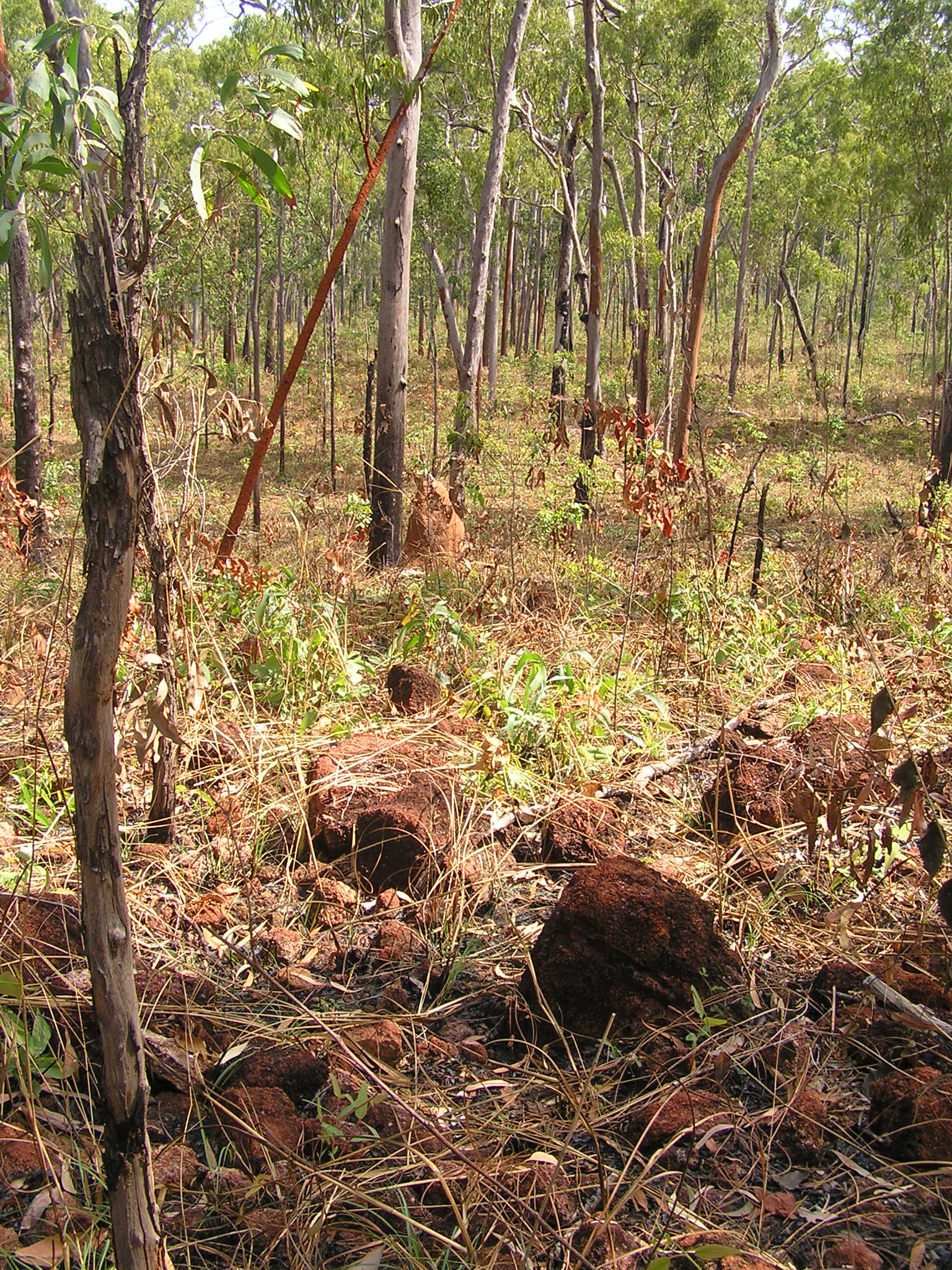
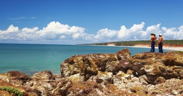
Cemented bauxite boulders at the Jump Up, near the area visited by Harry Evans in July 1955. Photo: Geoff Wharton.