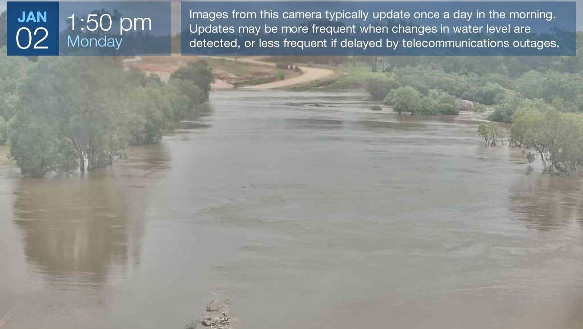
Queensland’s Traffic website briefly had access to the camera at Archer River before it was taken down.
JUST a handful of days.
That’s how long pictures were made available of the Archer River causeway on the Queensland Traffic website before being removed last week.
It’s a move that has frustrated Cape York motorists.
The camera images were able to provide an accurate depiction of the river level, which helped motorists decide on whether to leave home or stay put.
The state government has put cameras on most of the major creeks and rivers throughout the Cape and can access them at any time.
However, images from just a select few are published online.
Northern Cape motorists say that images from Myall Creek, the Archer River and Morehead River should be made public.
The Bureau of Meteorology publishes the Archer River level on its website using data from the Department of Regional Development, Manufacturing and Water.
However, the water levels on the BoM site in relation to the causeway are incorrect.
Archer River Roadhouse’s Brad Allan said the measurement had been out by “up to a metre” this wet season.
The Department says the river levels are accurate, however acknowledged the line on the graphic indicating the height of the causeway may have been incorrectly calculated by either Cook Shire or the Department of Transport and Main Roads.
“The DRDMW gauging station 922001A Archer River at Telegraph Crossing measures the water height of the watercourse directly adjacent to the gauging station, which is about 3km from the PDR causeway,” a Department spokesperson said.
“The quality of the data being collected at this site has been checked and verified.
“The site was last visited by staff on November 23, 2022, in preparation for the wet season.
“The flood indicator marker on the PDR causeway was not installed by DRDMW and may have been placed there by TMR or Cook Shire Council as an indicator of the height above the causeway.
“This is not linked to the height data collected by the DRDMW Archer River gauging station.
“Any further enquiries about the flood indicator markers or cameras should be directed to TMR or Cook Shire Council.”
● Cook Shire publishes images from some cameras on its Disaster Dashboard, although the Archer is not one of them.