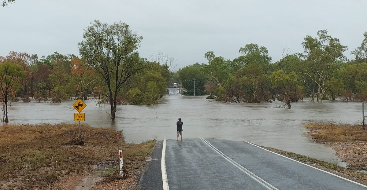
The McLeod River near Mount Carbine has cut off the Mulligan Highway.
Cyclone Jasper may have arrived with a whimper, but his wake has caused widespread flooding and damage across Far North Queensland.
At the time of writing (8pm on Sunday, December 17), road travel was almost impossible in the southern part of Cook Shire, Wujal Wujal, Mareeba Shire, Douglas Shire, Cairns Regional Council and large parts of the Cassowary Coast and Tablelands councils.
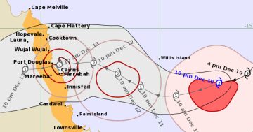
More than one metre of rain has fallen at dozens of locations around the region, causing flooding in rivers and creeks. This is a result of a monsoonal trough caused by ex-TC Jasper that is sitting on the coast from Cooktown to Cairns, dropping heavy falls over the last 72 hours. There are also storms on the Western Cape impacting Weipa, Aurukun, Napranum and Mapoon.
ROADS AND AIRPORTS
The Peninsula Developmental Road between Weipa and Laura is impacted by flooding at the Kennedy, Hann and Laura Rivers.
The Mulligan Highway between Cooktown and Mareeba is cut off at several places, including the McLeod River near Mount Carbine, as well as the Rifle and Spear Creeks at Mount Molloy.
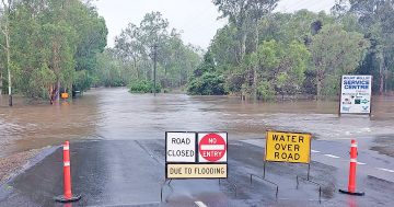
The southern part of Cook Shire is experiencing a lot of localised flooding around Cooktown and Rossville. Once the rain stops, most of those roads will reopen quickly.
The three range roads into Cairns – Rex (Mt Molloy to Mossman), Kuranda (Mareeba to Smithfield) and Gillies (Yungaburra to Gordonvale) – are closed, as is the Palmerston Highway, which connects the Tablelands with Innisfail.
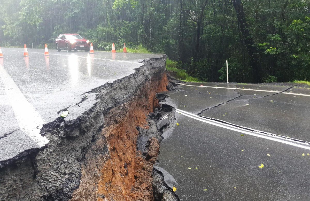
The Palmerston Highway has been badly damaged.
Road networks in Cairns are also under siege. Travel between the CBD and Smithfield/northern beaches is impossible, while access to the southside is also cut off.
This afternoon, Cairns Airport suspended all flights in and out after large flooding on the runway and at the terminals.
POWER NETWORK
Ergon has reported that tens of thousands of homes have lost power in the Far North. Most places in the Cape have kept the lights on, although Wujal Wujal and parts of Ayton lost power around 5am Sunday and local leaders don’t expect it to come back any time soon.
“Ergon put a generator in place before the cyclone but unfortunately they didn’t leave anywhere here to activate it,” said Kiley Hanslow, the CEO of Wujal Wujal Aboriginal Shire Council.
“It’s also going to put a strain on our telecommunications because the phone tower is running on battery and that means we only have about 36 hours of phone service left.”
The council told residents it would switch off the 4G at 11pm and turn it back on in the morning to preserve power. The 3G network would still be on for phone calls in case of an emergency.
Ms Hanslow said the only generators operating in Wujal were at the council offices and the council depot.
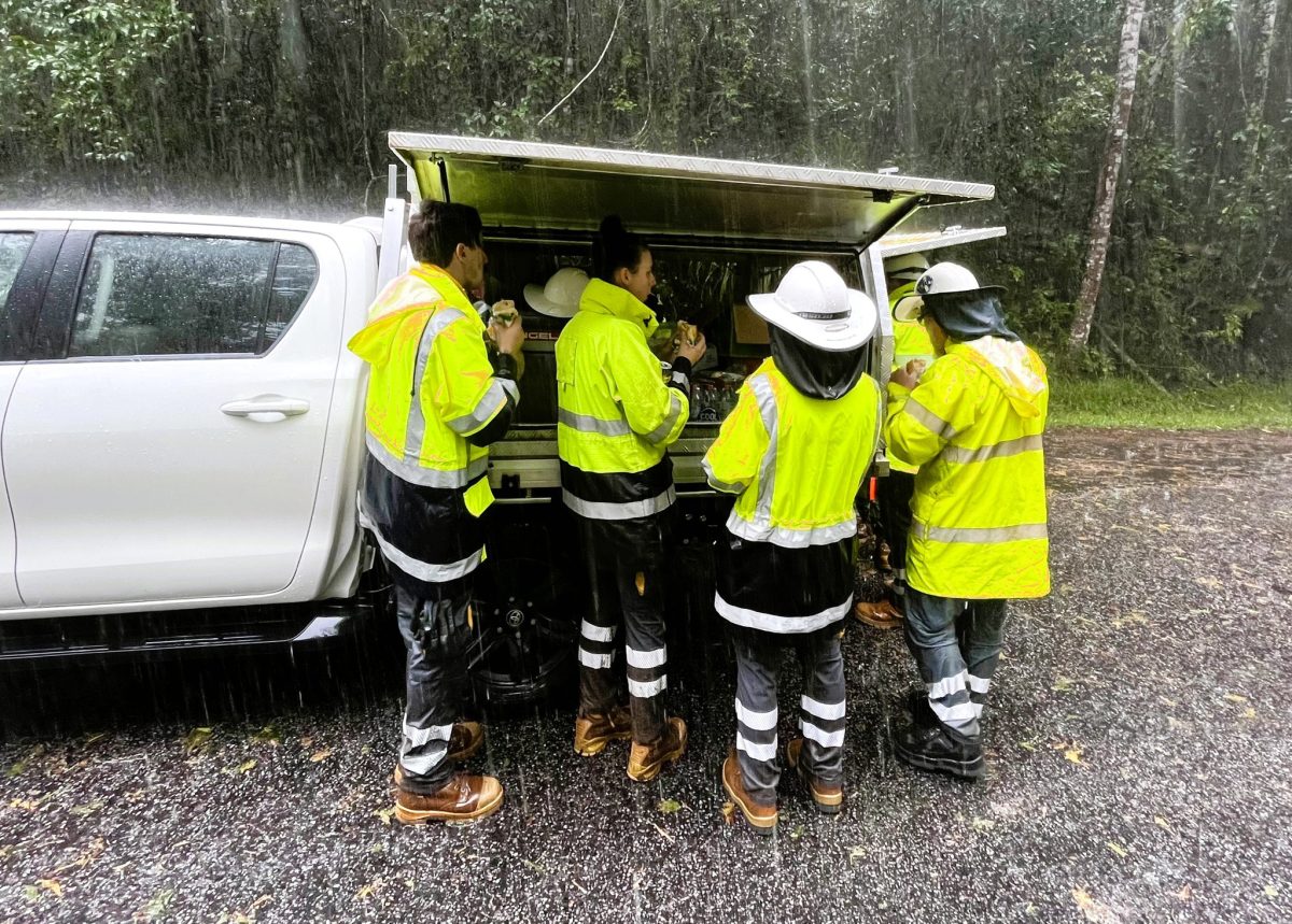
Ergon Energy workers have a brief break in the rain.
“Our water treatment plant and our sewerage treatment plant are not running … the shop is closed because they can’t get in from Ayton to open it.”
Wujal Wujal Aboriginal Shire Council coordinated the evacuation of dialysis patients and pregnant women prior to Jasper’s arrival, knowing that the community could face isolation.
“We did quite well when Jasper hit but this rain afterwards has hit hard,” Ms Hanslow said.
TELECOMMUNICATIONS
Most parts of Cape York still have phone service, although Mapoon lost its Telstra coverage on Sunday, local councillor Kiri Tabuai said.
Weipa lost its NBN service on Thursday night and households are still without internet and that’s unlikely to change until NBN Co can get a helicopter to access the location of the breakdown, believed to be in a remote location.
ESSENTIAL SUPPLIES
Most Far North Queensland residents are well prepared for cyclones and storm surges, although some got caught on the back foot by the severity of the flooding post TC Jasper.
Supermarkets and local stores are running low on items such as bread and milk, although most have plenty of dry stores.
“The Cooktown IGA saw Jasper coming and got two additional trucks in just before it arrived,” said Cook Shire Council’s disaster management officer Narelle Dukes.
“People might have to go without some things but they won’t starve.”
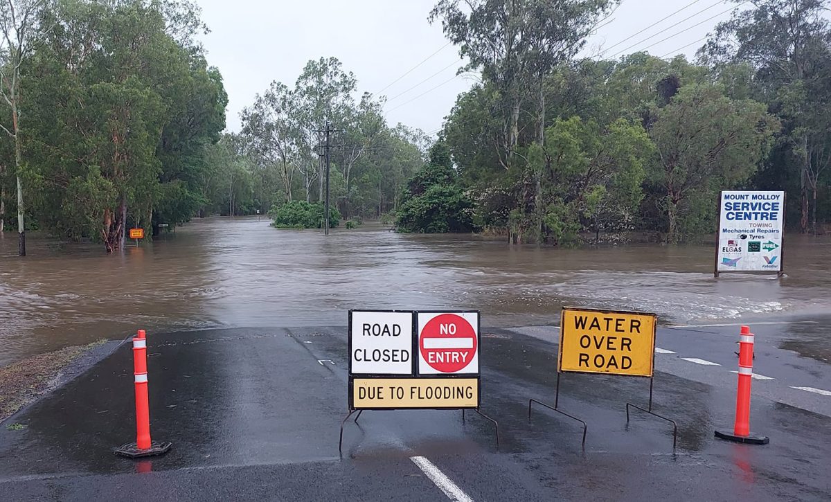
Mount Molloy is without power and residents are unable to travel in or out.
Cook Shire has a Local Disaster Management Group meeting on Monday to discuss if supplies need to be flown in and if isolated residents need assistance.
THE DAYS AHEAD …
The Bureau of Meteorology says more rain is likely on Monday and is unlikely to ease until Tuesday.
Air travel on Monday appears unlikely, however, airports may open in the afternoon or on Tuesday morning. Travellers are urged to keep an eye on their airline’s website or social media pages for updates before heading to the airport.
The Peninsula Developmental Road will reopen once the river levels drop. There could be damage to the Mulligan Highway once the water recedes, which could delay the opening of the road between Lakeland and Mareeba.
There is a concern that there is more rain coming towards Christmas, which could extend closures or reduce the window for road travel.
For immediate updates, follow the Cape York Weekly Facebook page, which is providing news as it drops in.