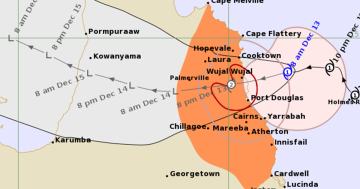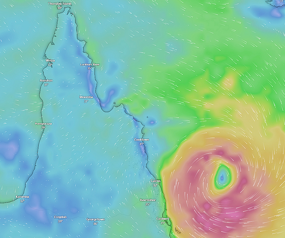
Cyclone Jasper is likely to make landfall around Port Douglas at lunchtime on Wednesday.
Cape York should avoid the brunt of Cyclone Jasper’s wrath, the Bureau of Meteorology reported on Monday, although residents should continue to monitor updates.
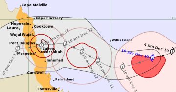
At the time of writing, Jasper had weakened to a category one system, although is expected to strengthen to a category two cyclone when it makes landfall around lunchtime Wednesday.
The eye of the cyclone is expected to cross the coast around Port Douglas, although it could still shift north or south.
Senior meteorologist Angus Hines said despite the system weakening from a category four on Saturday to a one on Monday, it was still a “significant weather system”.
“We will certainly start to feel the effects of the storm earlier than that even though it’s positioned out over open waters,” he said.
“That will start with the winds picking up across parts of the Queensland coast.
“Strong to damaging wind gusts are forecast from Monday with a current severe weather warning in place for Mackay up to Bowen.”
“It’s going to be extremely intense’
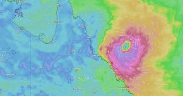
Mr Hines said the “most intense, most severe weather” was expected right about the time the cyclone arrived on Wednesday.
“That is likely to generate damaging to destructive wind for parts of the Queensland coast,” he said.
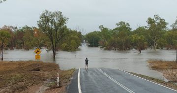
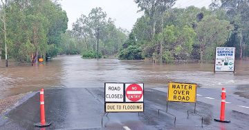
He said persistent heavy rainfall could lead to flooding on the coast and further inland, and there would be “exceptionally dangerous conditions” out on the water.
Mr Hines said the damaging wind gusts could be in excess of 150 kilometres per hour.
“That can cause significant damage to property, it can bring down trees, powerlines, cause widespread power outages,” he said.
“People who are caught in the worst of it … it’s going to be extremely intense and very severe weather.”
GULF WATCH
There are concerns that Cyclone Jasper could cross Cape York Peninsula as a tropical low and reform in the Gulf of Carpentaria later this week.
Councils in the Gulf are already planning in case it decides to stick around or even turn around.